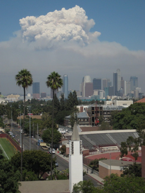
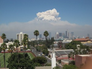
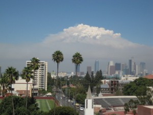
 Stepping back from the unpleasantness going on at ground level for a moment (see the four previous posts, 1, 2, 3, 4), it seems that there is something else going on that’s actually quite fascinating. I went over to the top of one of the USC campus parking structures to take a look and gather some data and I’ve been chatting to people at random about it*. (This might also be a sign that I’m procrastinating on some other task… 🙂 ) That white part of the cloud is not smoke, is it? It is actually a cloud of vapour. Like a cumulus cloud you’d normally see in various weather conditions. I’ve heard some chatter about these systems “making their own weather”, and I can see that you could get a lot of localized heat dragging air in from other areas and so creating winds and so forth, but is that also generating this cloud? If so, how? Where is it getting all this moisture from? Is it from the water that is being dropped on it? Not sure, since structures like this were there during the periods that they were not dropping water, right? Not sure. Does anyone out there know? Have thoughts? Do share. Another relevant bit of data is that I’ve noticed that the shape changes a lot over the space of five to ten minutes (all photos here can be enlarged by clicking on them):
Is this because new water is added by an aircraft drop? can one drop have such a huge effect though? I imagine that a lot of the localization of the shape (that it is not just billowing away) might be helped by it creating an inflow from the surroundings, adding stability to the structure, so maybe the whole thing is a creation of both human activity and Nature in concert. [Update: See the comments. Keyword seems to be: pyrocumulus.]
Quite (tragically) beautiful, and very interesting. Discuss.
-cvj
(*Thanks Daniela, Lisa and Krzysztof for chatting about this…)


During controlled burns, which are usually done during very still, stable (inverted) conditions, you often have a flat hazy smoke cloud, where the particulates get trapped by the inversion, and the na big white vapor cloud that is moist enough to punch through.
That’s fantastic!! Thanks.
-cvj
Here is an interesting time lapsed video of the smoke from the fires plaguing SoCal at the moment… Kind of unnerving to say the least.
http://www.brandonriza.com/Video/HTML/ZeroPercentContained.html
Pingback: Mt. Wilson Observed | Lascher at Large
Michael, Danny, thanks! I also had a facebook comment pointing me to “pyrocumulus” clouds.
One site I saw (take with usual pinch of salt: http://en.wikipedia.org/wiki/Pyrocumulus_cloud ) also discusses the rain they can produce, and also I heard discussion on the radio that they can also produce lightning, as Danny says. Presumably this means that these things can start new fires as well as possibly put themselves out!
-cvj
I have seen plenty of forest fires making these kinds of clouds when there were no large water drops.
I agree with Tobis, the extremely hot air rises extremely fast and adiabatically just like in a thunderstorm. In fact, its probably extremely dangerous to fly through these convective columns. As to the source of the water its probably a combination of water already in the air, water from combustion products and vaporized water from soil and plants.
Never heard of rain from fire clouds but there can definitely be lighting!
Well, I’ve been asked for a comment, so presuming nobody will shoot me if I’m wrong, I’ll venture one.
The fire is creating hot air which is being lifted. Assuming the air has more than 0% humidity, it has a lifting condensation level, and it appears it is being lifted above that level. So you get cloud droplets.
It’s probably smaller than a normal convective cloud, and there’s presumably plenty of turbulence around, so that accounts for the rapid changes in shape and the failure to set off convective instability.
Alas, I am guessing. Don’t take this to the bank. But it seems about right to me.
PS – Oh, Google is my friend. It offers:
http://www.hko.gov.hk/aviat/outreach/observation/pyro_cu.htm
“Large and intense forest fires release enormous amount of water vapour that may rise and produce cumuliform clouds called pyro-convective clouds.”
It would seem possible from these pictures that an especially clever fire might conceivably build a cloud big enough to put itself out.